Why Choose Us
Your Trusted Partner for Topographical Surveys


Your Trusted Partner for Topographical Surveys

Our team is committed to delivering results within agreed-upon timelines without compromising on quality. We have efficient project management systems in place to ensure smooth workflow and timely communication.

We prioritize accuracy and precision in every aspect of our work. Our meticulous attention to detail, rigorous quality control measures, and use of advanced surveying techniques ensure that our survey results are highly accurate and meet industry standards.

Client satisfaction is our top priority. We take the time to understand your specific requirements, project goals, and budget constraints. Our team provides personalized solutions and regular updates throughout the surveying process.

We pride ourselves on delivering exceptional customer service. Our team is always available to address your queries, provide professional guidance, and ensure a smooth and hassle-free experience from start to finish.
Our service process is designed to ensure a smooth and efficient experience for our clients.

We begin by scheduling an initial consultation to understand your project requirements, objectives, and timeline. we prepare a detailed project proposal that outlines the scope of work, deliverables, timeline, and cost.

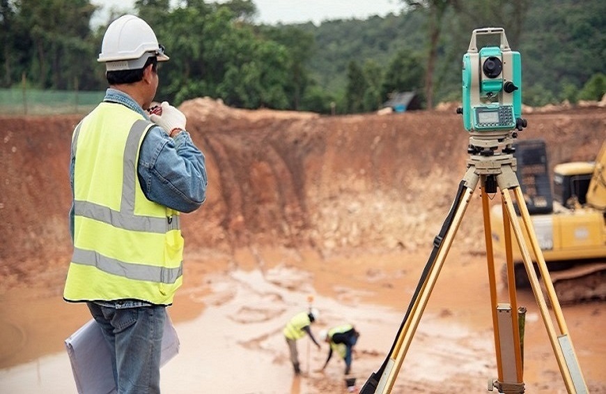
Our survey team conducts a site visit to assess the project area. We carefully examine the terrain, existing structures, and any other relevant factors that may impact the survey.

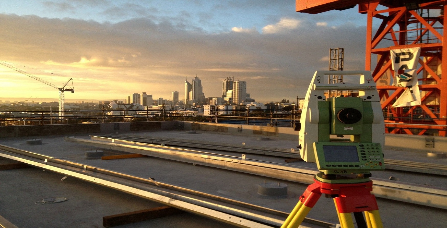
We develop a comprehensive survey plan, considering the specific requirements. We utilize advanced surveying equipments and techniques to collect precise data, ensuring accuracy in survey parameters.

Our skilled technicians use specialized software and tools to analyze the survey data, apply necessary corrections, and generate accurate results.

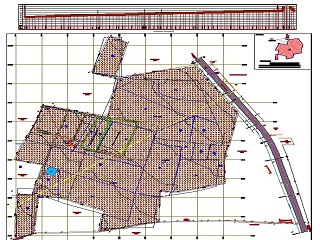
We prepare a comprehensive survey report that presents the findings, analysis, and relevant information. The report may include maps, plans, digital models, and other visual representations as required

We encourage you to review the survey results and provide feedback. We are available to address any post-survey inquiries, provide additional support, or discuss future projects.
We specialize in delivering top-notch survey services of the highest quality.
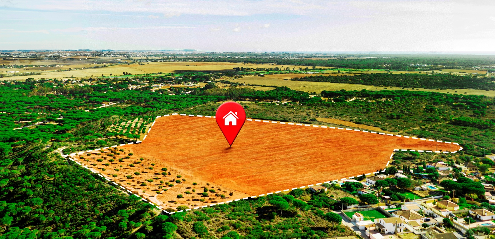
A topographical survey is a specialized service we offer to accurately map and depict the features of a land area.
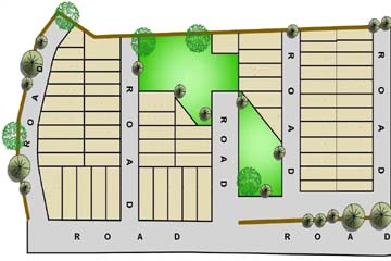
Land survey services encompass comprehensive and precise measurements, mapping and analysis of land areas.
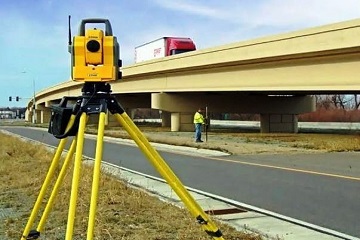
Road survey services involve the precise measurement, analysis and mapping of roadways to gather essential data.
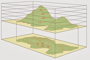
Contour survey services involve the precise measurement and mapping of elevation points on a given land area to create contour lines which provide information about the shape and slope.
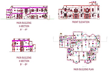
Physical survey services encompass a detailed examination and measurement of physical features on a land or property, including buildings, structures, utilities, boundaries and other relevant elements.
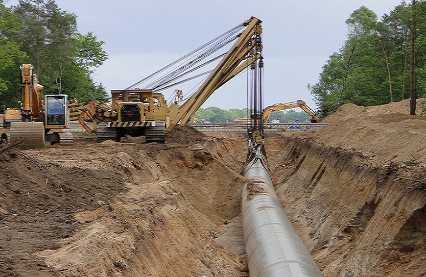
Pipeline survey services specialize in the accurate mapping and assessment of pipelines, including their alignment, location, elevation and condition which helps in identifying potential issues of pipelines.
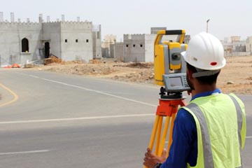
We accurately determine the positions, orientations, and dimensions of proposed structures, roads, utilities, and other features on the project site.
Project survey services support various construction projects by providing precise measurements, mapping and analysis of the project site.
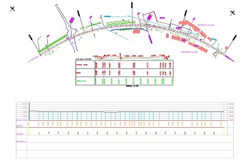
Our company specializes in providing layout, L-section, and cross-section services to support construction and infrastructure projects.
Get answers and advice from people you want it from.