

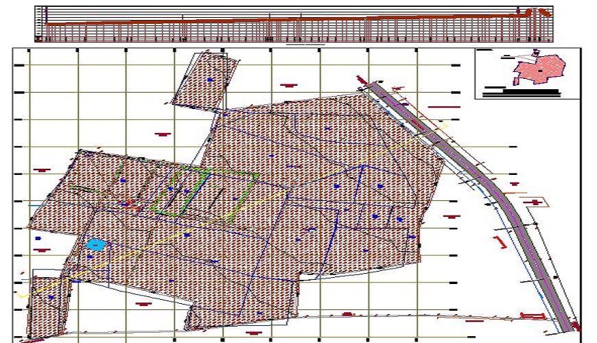
A topographical survey, also known as a land survey or a topographic survey, is a detailed mapping of the physical features and characteristics of a particular area of land. The purpose of a topographical survey is to accurately measure and represent the elevation, contours, natural and man-made features, and other relevant details of the land's surface.
Topographical surveys have numerous applications in different fields, including urban planning, civil engineering, architecture, environmental assessment, infrastructure development, and land management. They provide crucial information for making informed decisions, ensuring the efficient use of land, and facilitating safe and sustainable development.
The surveyors use specialized equipment such as total stations, GPS receivers, or LiDAR (Light Detection and Ranging) to measure the elevation at various points across the survey area. This data helps create contour lines, which are lines that connect points of equal elevation, providing a visual representation of the land's shape and slopes.
A topographical survey records various features present on the land, including hills, valleys, bodies of water (rivers, lakes, ponds), vegetation, trees, roads, buildings, fences, utility poles, and other structures. Accurate measurements and locations of these features are essential for planning and development purposes.
Topographical surveys often include the identification and mapping of property boundaries, indicating the limits of a particular piece of land. These boundaries are important for landowners, developers, and government agencies to determine ownership rights, plan land use, or resolve any potential boundary disputes.
The survey may also involve locating and mapping the underground utilities and infrastructure present in the area, such as water and sewer lines, gas lines, electrical cables, and telecommunications networks. This information is crucial for avoiding conflicts during construction or maintenance projects.
The data collected during a topographical survey is typically used to create detailed maps, plans, and digital models. These deliverables provide a comprehensive visual representation of the surveyed area and are used by architects, engineers, urban planners, and other professionals for designing and implementing various projects.
Get answers and advice from people you want it from.